The name “Nevada” is Spanish for “snow-covered”. While the early Spanish explorers coined this name for the Sierra Nevada mountain range to the west, the fact is Nevada has more mountain ranges than any other state. The highest mountain in the state is Boundary Peak, at 13,146 feet, on the west-central border with California.
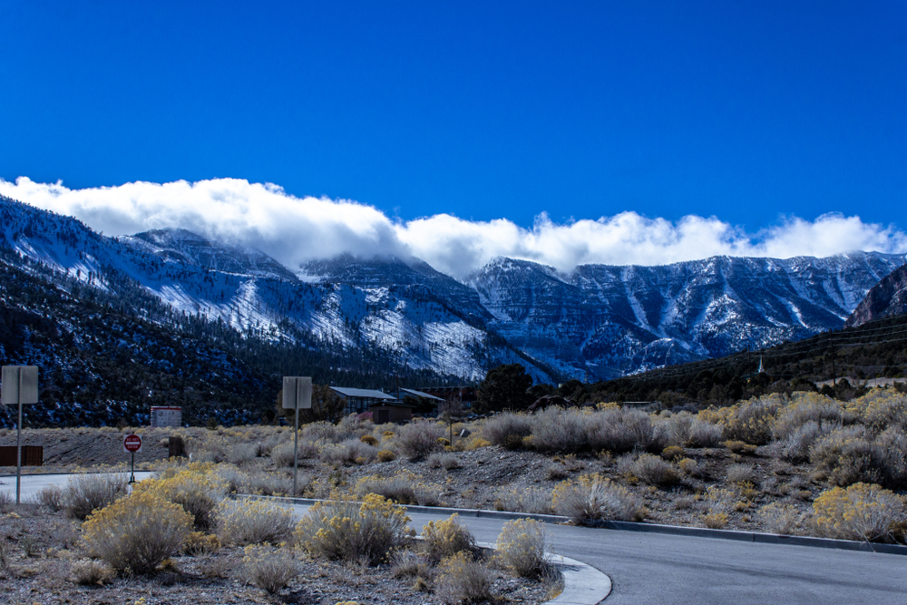
The mountain ranges are home to the state’s lush forests, hidden high above the heat of the desert floor. The largest mountain range in Southern Nevada is the Spring Mountains, just west of Las Vegas. In fact, if you visit Las Vegas in the winter, early spring, or late fall, you may notice a majestic, snow-covered peak to the west. That’s Mount Charleston; at 11,916 feet, it’s the eighth highest mountain in the state.
Mount Charleston is within both the Spring Mountains National Recreation Area as well as the Humboldt–Toiyabe National Forest. The mountain is a year-round magnet for Las Vegas’s nature-loving residents and visitors alike, providing not only a number of biking and hiking trails but a ski area as well, all just 35-miles from Vegas.
Bristlecone Pine
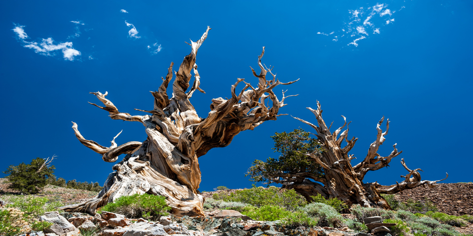
One thing Mount Charleston is known for is its bristlecone pines. Bristlecone pines are the oldest living things on earth, with some trees living for nearly 5,000 years. Bristlecones grow in the lonely, windswept, isolated groves around Mount Charleston’s tree line. The oldest bristlecones thrive at elevations of 10,000 to 11,000 feet, a place that often seems devoid of life. The venerable bristlecone pine has the honor of being named the state tree of Nevada. If you happen upon a bristlecone during your visit, please be respectful.
Getting to Mount Charleston
You can escape the heat of the city to Mount Charleston in less than an hour. All you have to do is get onto Highway 95 going north. Take the exit for NV Hwy 157/Kyle Canyon Road, turning left onto NV Hwy 157 W/Kyle Canyon Road. At the roundabout, stay to the right, and take the second exit onto NV-157 W until you see the Spring Mountains Visitor Gateway.
The Spring Mountains Visitor Gateway
The visitor center is at 2525 Kyle Canyon Road, Mt. Charleston, Nevada. This is a 128-acre complex of public buildings, trails, exhibits, and lots more. You can just make a quick stop to pick up a map; the maps and brochures include a general area map, hiking trail maps, OHV trail maps, the snow play map, a winter visitors guide, and a summer visitors guide.
You can also go hiking on one of the trails here. The 40-miles of trails starting here are good for all skill and fitness levels.
Kyle Canyon Picnic Area
The picnic area is approximately 18 miles from where you turned off Highway 95, on the left side of the road. It’s $12 to stop in for the day.
This year-round day-use area is set in a forest of majestic ponderosa pine, Gambel oak, and mountain mahogany which provide some shade in the summer. Wild roses and manzanita grow dot the landscape, and a seasonal stream parallels this lovely oasis. From here, you can see the towering canyon walls and experience the fresh mountain air.
You can also pick up the 1.6-mile Fletcher Canyon Trail here. The trail is relatively easy, but remember, you’re at 7,841 feet, so it may seem more strenuous. This is a beautiful hike, gradually going uphill through pine forest along the seasonal stream. The hike ends at beautiful Fletcher Canyon, a slot canyon with 200-foot walls of rock and a fabulous view of Mummy Mountain.
Camping Around Mount Charleston
There are several campgrounds on the way up to Mount Charleston where you can pitch your tent under the pines. The panoramic views of the mountains are a haven for solitude. From the rugged Old Mill Campground to the RV friendly McWilliams Campground, there’s something for everyone. However, these campgrounds are popular, especially during the summer, so make your reservations well in advance. The Forest Service allows RVs to camp at six out of the seven campgrounds in the Spring Mountains. The Old Mill Campground doesn’t accommodate RVs, and the Hilltop Campground can’t accommodate RVs over 25 feet in length. Be sure to check the Forest Service website before you go, to make reservations and check for any restrictions.
Mount Charleston is also a mecca for dispersed camping; if you enjoy the solitude and the primal experience of camping outside of the developed campgrounds, dispersed camping is for you. Dispersed camping around Mount Charleston means no services like restrooms, trash bins, picnic tables, or fire pits.
The best areas for dispersed camping include Champion Road, Mack’s Canyon, and Lovell Canyon. But be aware that it can get crowded in the summer. Always drive on existing roads and 100 feet from any spring or stream. Remember to leave no trace, and pack it in, pack it out.
Hiking Trails
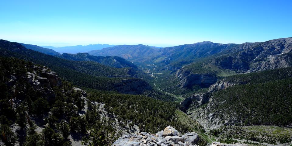
There are more than 60 miles of maintained hiking trails winding through this mountainous and rugged region. Most of the trails start at 6,000 feet or higher in elevation and some end at the top of the 11,916 Charleston Peak.
Hikers need to be prepared for intense sun exposure due to the high elevation and also be prepared to turn back or shelter in place if a lightning storm happens during the summer. Also, sudden snowstorms are possible from fall through spring, and in the winter every trail can be impassable due to snow and ice. Watch the weather; it can be unpredictable and intense.
The Acastus Trail is a relatively easy, 2.6-mile trail that can be accessed at the Spring Mountains Visitor Gateway. The Acastus Trail is paved and only has gentle ups and downs in elevation.
The Pack Rat Route is a nice, easy half-mile loop through the pinyons and junipers starting at the Spring Mountains Visitor Gateway. The trail crosses into the Kyle Canyon wash and up a hill to a telescope, where you can view the wreckage of a military plane crash that occurred on Mount Charleston.
The Cathedral Rock Trail is more difficult, covering nearly 3 miles through ponderosa pine and white fir. In the summer, this is a colorful area blooming with wildflowers and butterflies. However, this area is known for avalanches and is closed during the winter.
Robber’s Roost is a moderate 1.4-mile loop that climbs up a canyon, weaving through the pinyon pines and mountain mahogany to caves. There’s some moderate rock scrambling on this trail.
The Desert View Overlook Trail is really 0.1 mile of paved walkway. The Desert View Overlook provides impressive views of the Mojave Desert way down below, and it was a well-known vantage point for nuclear bomb detonation back in the 1950s and 1950s.
The Sawmill Trailhead is an easy, 2.6-miles weaving its way through the pinyons and junipers. In the spring, there’s an abundance of wildflowers, and year-round there are amazing views of Mummy Mountain.
The Upper Bristlecone Trail is a moderately difficult 6-mile hike. This trail starts in the white fir and aspen and climbs to the legendary bristlecone pines. There are plenty of places to stop, rest, and admire the views along the way.
Skiing on Mount Charleston
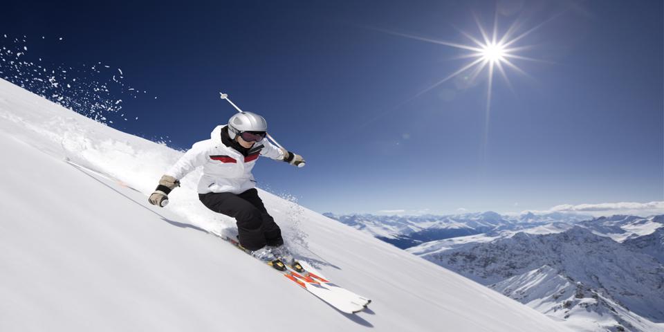
People have been skiing the north-facing slopes of Mount Charleston since the early 1930s. The Lee Canyon Ski Area was created by the Forest Service in 1964, when it issued a Special Use Permit for winter recreation in Southern Nevada.
Lee Canyon has a day-lodge with more than 445 acres of hiking terrain. There are 860 vertical feet of lift-served slopes, 3 lifts, 24 snow trails plus a tubing area. This is Las Vegas’ secret mountain getaway.
While Las Vegas is a haven for snowbirds escaping the winter weather back East, the winter road conditions on Mount Charleston and Lee’s Canyon can be icy and slushy. Make sure your vehicle can handle icy roads and snowy parking lots. You very well could need chains or snow tires, and a 4×4 vehicle is recommended. With no gas stations up here, make sure you start your trek with a full tank. Balmy weather in Las Vegas doesn’t mean it’s not extremely cold up on Mount Charleston.
While there isn’t lodging at the ski resort, there is lodging several miles from the ski area. The Retreat on Charleston Peak is at the intersection of Highway 157 and Highway 158; the ski area is down the road on Highway 158. The Retreat on Charleston Peak is a collection of rustic stone and log buildings with three excellent restaurants. It’s open year-round, and it’s not only a cozy place to spend a winter weekend but a great home-base in the summer too, close to almost all of the hiking trails.
So now you know one of the best kept secrets of the Las Vegas locals. It’s rugged and wild, so be prepared for an epic outdoor adventure. Majestic Mount Charleston is a cool getaway, no matter what time of year you go.