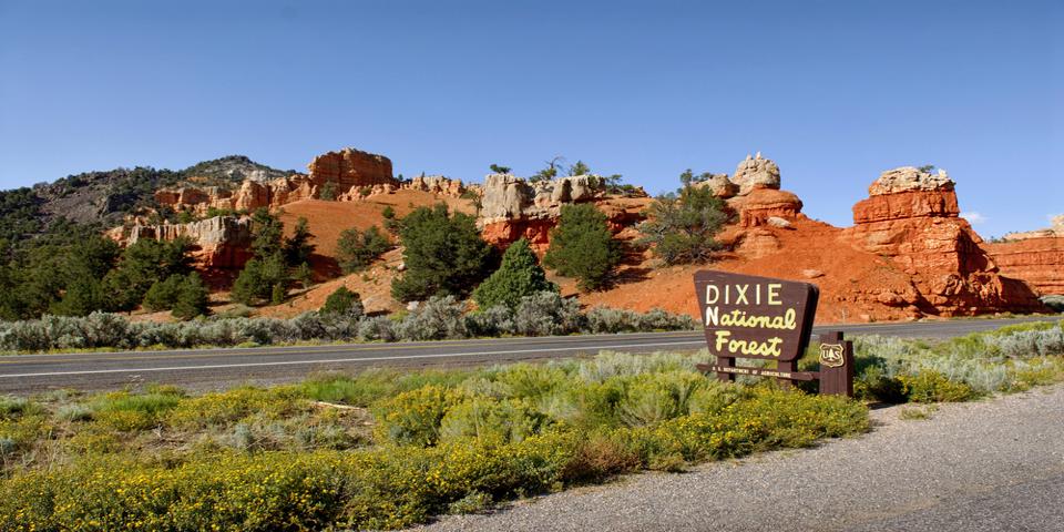
Not far from Las Vegas is a two-million-acre forest brimming with natural wonders. The Dixie National Forest is a wonderland of steep mountains, deep canyons, unusual rock formations, crystalline lakes, and towering pines, and an amazing land of contrasts.
The Dixie National Forest is at the heart of Southern Utah’s world-renowned landscapes, surrounding the well-known National Parks and Monuments. Scenic highways weave their way through the forest, providing easy access to the best known natural wonders between the Great Basin and the Colorado River. The landscape ranges from red rock deserts and deep canyon gorges to alpine forests and lakes.
A Long History
The Dixie got its name from settlers from the deep south, who came to the region to grow cotton. However, long before that, this land was the home of the Paleo-Indians, who hunted woolly mammoths and other extinct megafauna here. The Paleo-Indians were followed by other hunter-gatherers, who lived in the high country during the summer and moved to lower elevations in winter.
Petroglyphs, cliff dwellings, and other artifacts also indicate the presence of the Fremont and Anasazi in the Dixie National Forest from 500-1275 AD. These people were farmers who planted corn, beans, and squash. By the early 1300s, the Utes and Paiutes moved in from the west. These were the people living here when the first Europeans arrived, and they live in Southern Utah to this day.
Today, the Dixie National Forest is valued not only for its rich, natural resources, but also for its natural beauty and recreational opportunities. Camping, fishing, and hiking are popular here, and the dramatic differences in elevation mean the weather is always good, whatever time of year.
Getting to the Dixie National Forest
In 1776, Spanish priests, Fathers Escalante and Dominquez, forged a route known as the Old Spanish Trail. By the mid-1800s, fur trappers, prospectors, traders, and immigrants all traveled this road. Today, much of Interstate-15 follows the Old Spanish Trail.
Take I-15 all the way up to Cedar City Utah. That’s around 175 miles, and should take about 2 ½ hours to get there. From Cedar City, you can take scenic Utah Highway 14 over the mountains to Duck Creek.
Traveling Highway 14 State Scenic Byway
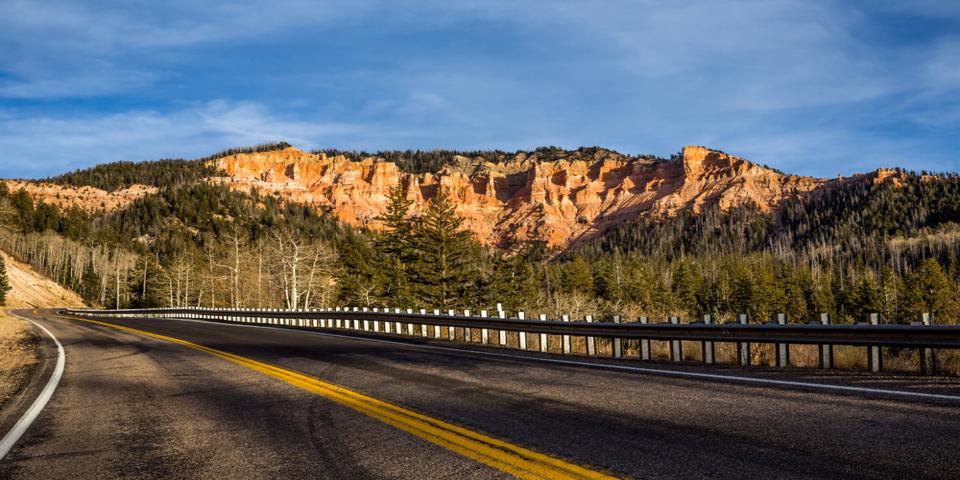
Highway 14 connects I-15 with Highway 89, also known as the Utah Heritage Byway. Be warned, Highway 14 involves steep grades, and 25 mph curves. It’s incredibly scenic, but it’s a little scary if you’re driving a motorhome or towing a trailer. It culminates at a 10,000-foot summit, which may be impassable in the winter. Gas up in Cedar City before you hit the road.
This scenic road winds its way from the red rock canyons around Cedar City, over the Markagunt Plateau, and past the idyllic Navajo Lake and Duck Creek.
The Markagunt Plateau is a volcanic field, consisting of cinder cones and lava flows. Some of the lava flows formed tubes such as at Mammoth Cave, and others formed lakes like Navajo Lake. In fact, legends of the Southern Paiute may record some of these past eruptions. From parts of the plateau, you can see down into Zion National Park, and from Strawberry Point, you can see all the way to the Kaibab Plateau in Arizona.
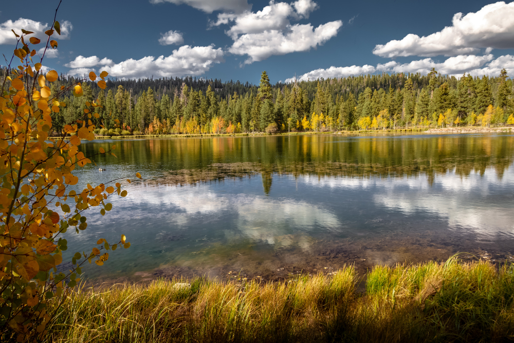
Once you get down the mountain, you’ll be at Duck Creek Village and the incredibly photogenic Aspen Mirror Lake. This small, tranquil alpine lake is a ½ mile hike from Duck Creek Village, and the views are amazing! Bring your camera, because the lake lives up to its name; in the fall, the vivid colors of the turning autumn leaves are perfectly reflected in the still waters of the lake.
Mammoth Cave is just east of Duck Creek Village on State Road 14, and a left on Forest Road 067. The cave simply looks like a big hole until you take a closer look. It’s fun to explore, but take a good flashlight; after the first turn, the cave is pitch dark. During the summer evenings, the cave is a popular place to spot several different bat species.
Navajo Lake is also close by. It was formed when lava flowed across the eastern end of the valley forming a shallow bowl. There’s a campground along the shores of Navajo Lake, and the lake is a spectacular setting for hiking, camping, fishing, and of course, photography. You can rent a boat here, and grab a bite to eat at the nearby Navajo Lake Lodge. The Virgin River Rim Trail near the campground has panoramic views of the Kolob Plateau, Zion National Park, and the Pine Valley Mountains.
Highway 89 to Panguitch
Once you’re down the mountain, take the scenic drive along Highway 89 up to Panguitch. From there, pick up Utah Scenic Byway 143, also known as the Patchwork Parkway.
The 55-mile Patchwork Parkway got its name from a historic incident that occurred in 1864; Mormon settlers from Panguitch were starving during the harsh winter. Desperate for food, they decided to cross the valley to the north, to Parowan. The snow was so deep, the horses and oxen simply sunk in, so wagons were out of the question. So a group of brave men used handmade quilts laid on top of the deep snow to walk the 55-miles. They reached Parowan and brought back food to save the people of Panguitch.
Panguitch holds its western heritage dear, and the Panguitch Quilt Walk is celebrated to this day with the mid-June Quilt Walk Festival. The old town is full of old, well-maintained buildings, and it’s a nice stop if you need gas or a meal.
Utah Scenic Byway 143, the Patchwork Parkway
The highway is also called the Brian Head-Panguitch Lake Scenic Byway as part of the Utah Scenic Byways, but called the Patchwork Parkway as a part of the National Forest Scenic Byway.
At a little more than 50-miles long, this road connects Panguitch to Parowan, as well as providing access to Panguitch Lake, the Brian Head ski area, and Cedar Breaks National Monument. The road reaches an elevation of 10,626 feet. Be warned, this road has several steep grades, as much as 13%, and a few 15 mph switchbacks. It’s not recommended if you’re towing a trailer.
One of the first stops along this road is Panguitch Lake, just 20 minutes from the town of Panguitch. It’s at an elevation of 8,400 feet, and is right along Scenic Highway 143. Panguitch Lake is well known for fishing, and in fact, “Panguitch” is derived from the Paiute word for “big fish.” Some of the state’s largest rainbow trout have been caught here. There is also lodging and dining here in this idyllic, alpine setting.
From scenic Panguitch Lake, the road climbs up through the forests to Brian Head. The air is very fresh and clear up here. There is a gas station in the ski resort town of Brian Head, as well as a few restaurants if you need to get a bite to eat. At 11,307 feet, Brian Head Peak is the highest point in Iron County. You may notice the unusual trees around Brian Head. The “Twisted Forest” is a rare grove of Bristlecone Pines, which are among the oldest living things on the planet; some of the trees here are more than 1,600 years old.
Perhaps the most stunning place along this road is Cedar Breaks National Monument; Cedar Breaks is a natural red rock amphitheater, spanning 3 miles across and more than 2,000 feet deep. It’s similar to the spectacular rock amphitheater at Bryce Canyon.
The rim of the amphitheater is more than 10,000 feet above sea level; due to its elevation, parts of the park are often inaccessible due to snow from October through May. The visitor center at the rim is open from June through October. Cedar Breaks’ campground, the Point Supreme Campground, is generally open from mid-June to mid-September, weather permitting.
From the Brian Head area, it’s all downhill to Parowan. It’s incredibly scenic, but this is where you’ll encounter the steepest grades and twistiest turns. Drive very carefully. You’ll definitely appreciate the bravery and determination the men of Panguitch demonstrated way back in 1864, when they hauled back enough food to save the town. This is a beautiful, but wild country.
You’ll finally reach Parowan. Parowan was one of the first towns established in Southern Utah, founded back in 1851. It’s known as the “Mother Town,” because it subsequently “gave birth” to Cedar City and St. George. While you’re here, you can make one last stop at the Parowan Gap, to see the petroglyphs and dinosaur tracks. Just drive down Main Street and turn west on 400 North. Go 8.4 miles to the Dinosaur Tracks sign on the north side of the road. To see the petroglyphs, drive west for another 2 miles to the sign that says Parowan Gap Petroglyphs.
From here, you can get back onto I-15 and head back to Las Vegas, or spend the night in Cedar City. One thing is for sure, you’ll go to sleep dreaming of the wild and beautiful land of the Dixie National Forest.